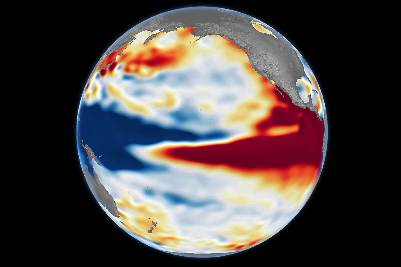
NASA’s October 23 Earth Observatory feature compares Pacific sea-surface-height patterns in 1997, 2015 and 2026 using satellite altimetry. The agency says the current pattern resembles the strong 1997 event.
The maps use observations from different satellite missions, including Sentinel-6 for October 12, 2026. Higher sea levels can indicate heat stored in the ocean. Similar ocean patterns do not guarantee identical local weather impacts.
Sources & references
See an error? Request a correction.